
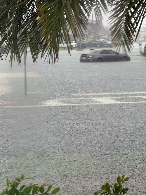
The St. Johns River near Cocoa, Florida, broke a record that had stood since October 1953, reaching 18.7 feet at 8:15 a.m. ET on Sunday, November 22, according to the National Weather Service office in Melbourne. The river had reached 18.74 feet the night before, more than a foot above the old record of 17.55 feet, and forecasters expected it to crest at about 18.8 feet on Sunday.
The rain has largely stopped, but the river is now the problem. The St. Johns is one of the flattest major rivers, so floodwater moves north slowly. Forecasters expect the river to stay high for days in Brevard County and for weeks farther north, with towns downstream facing rising water through Thanksgiving week even without new storms.
The flooding follows a week of rain along Florida’s east coast. Storms that hit South Florida early in the week moved up the Atlantic coast to the Space Coast on Thursday and into northeastern Florida on Friday. Some places on the east coast received more than 17 inches of rain from Tuesday to Friday, and several places had their wettest November on record. Cape Canaveral recorded 26.9 inches of rain in 48 hours. Flood warnings and watches covered about 200 miles of coastline, from just south of Melbourne to the Jacksonville area.
The scale of the response has been large. Brevard County reported more than 150 high-water vehicle rescues by Friday afternoon, with the hardest-hit areas in central Brevard, and Volusia County reported at least 30 rescues. The Florida Fish and Wildlife Conservation Commission reported well over 150 people rescued in Volusia County and about 120 in Brevard. Governor Ron DeSantis said more than 1,000 state personnel had conducted nearly 200 rescues and deployed 9,000 feet of flood barriers and 20,000 sandbags. Nearly 200 Florida National Guard members with 50 high-water vehicles were deployed, along with about 235 Fish and Wildlife officers.
No deaths have been attributed to this week’s flooding. Brevard County Sheriff Wayne Ivey said on Thursday that nobody had lost their life in the storm, and on Friday, West Melbourne police said a death the sheriff had linked to the storm was not storm-related. In Rockledge, Huntington Lane north of Barton Boulevard was still impassable on Saturday with waist-high water, and many homes there had close to a foot of water inside. A voluntary evacuation remains in effect in Rockledge.
For many residents, this was the second flood in three weeks. On November 1 and 2, south Brevard took 15 to 20 inches of rain, and the National Weather Service declared a flash flood emergency for Palm Bay and West Melbourne. Melbourne resident Jazmin Foster told the Associated Press her home had flooded twice in two weeks.
Downstream, the water is still coming. Above Lake Harney, the river is in major flood and was forecast to crest at 13.1 feet on Sunday night. At Sanford and DeLand, the river is in moderate flood and forecast to reach major flood this week, with Sanford expected to reach major flood stage by Thanksgiving Day. At Astor, the river is already in major flood, with further rises forecast. The National Weather Service says that at major flood stage, water rescues and evacuations are necessary and most low-lying homes near the river become uninhabitable.
